
Walks and Maps
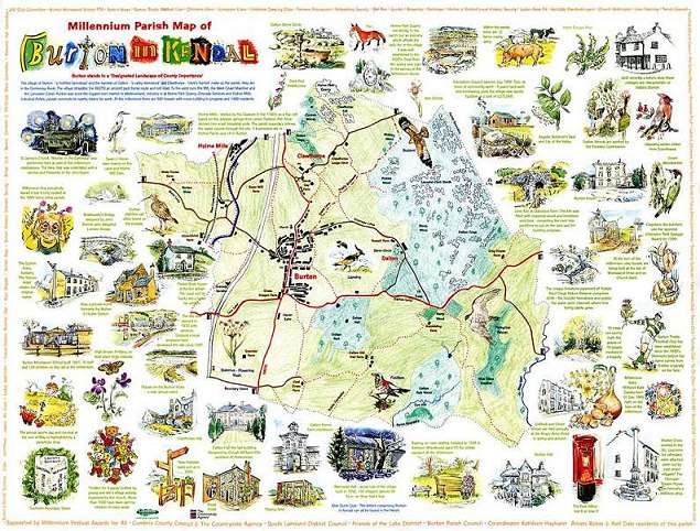
MILLENNIUM MAP
To download a higher resolution version of this map, please click the link below to open it in your browser or right-click the link below and select Save As or Save Link As to save a copy to your computer: Burton-in-Kendal Millennium Parish Map 2.1Mb
JUBILEE WALKS LEAFLETS
As part of the village's celebration of the Golden Jubilee of HM Queen Elizabeth II in 2002 a series of four walks was commissioned by Burton-in-Kendal Parish Council. Each double-sided leaflet includes a map and description of the walk and can be printed out onto an A4 sheet of paper. The walks are available as free PDF leaflets from below:
Walk 1 - Four Nature Reserves
This is a 8 km (5 miles approx) circular walk using public footpaths and rights of way. Duration of walk approx 2 1/2 hrs (excluding stops).
Walk 2 - From Stone Circle to Peat Bog
This is a 6 km (3¾ miles approx) circular walk using public footpaths and rights of way. Duration of walk approx 2 hrs (excluding stops).
Walk 3 - Lost Village and Parkland
This is a 8 km (5 miles approx) circular walk using public footpaths and rights of way. Duration of walk approx 2 1/2 hrs (excluding stops).
Walk 4 - Hanging Hill to Mossland
This is a 6½ km (4 miles approx) circular walk using public footpaths and rights of way. Duration of walk approx 2 hrs (excluding stops).